Archaeology
NascoBLOG 14
13/10/14 08:08
(c) William James Veall
"Portraits of the Gods": William J.Veall interviewed on Earth Ancients Interviewer Cliff Dunning
Listen to the fascinating Audio interview between Cliff Dunning, Host of Earth Ancients and English Archaeoastronomer, William James Veall, broadcast on Blogtalkradio.com, 27th September 2014.
An interview which, according to the Host, Mr Cliff Dunning,1st Oct 2014 and I quote:
William,
'Your interview on Earth Ancients is fast becoming the most popular that I've encountered'.
...'there has, to date, been over one thousand downloads of the audio programme, in just a few days, (a record).'
'Lets keep the option open for a future programme'.
And again on the1st October 2014 Mr Cliff Dunning wrote:
'Portraits of the Gods' is now the Number One, Alternative News Programme for the week on Blogtalkradio.com. They have 20 million listeners each month, so a number one spot is a significant achievement.
Cliff Dunning.
General: Cliff Dunning questions many aspects of my early research into Peru's pre-Columbian cultures and how my investigations eventuallly led to the discovery of the quite unique and rare imagery depicted in my new book "Portraits of the Gods".
Cliff pressed me to tell the listeners a little of the background of how I also came to make the momentous exposure of no less than five completely unknown archaeological sites on the High Altiplano of Southern Peru's, Andean Mountain chain, again, as described in "Portraits of the Gods". Not counting, the unbelievable discovery of a massive 3rd to 4th century, BC, Phoenician inscription actually imprinted within the Nasca Lines.
Below are some of the topics discussed during the interview:
---- In the beginning
---- Southern Evening Echo (UK) interview
---- Exploratory visit to Lima, Peru
---- The Nasca Lines and Phoenician inscription
---- Advances made after using Remote Sensing Satellite technology
---- "The Temple of the Sacred Lamb"
---- Discovery of the "Plaza of the Gods"
---- Discovery of the "Scriptorium"
---- The link between the "Linear Observatory" and the "Planetarium"
---- Peer reviews available ? Question from Mexico
---- Funding Stage Two of the Project. How?
Please now log on to the link below and listen to the fascinating audio that broke Earth Ancients, audience record; then went on to become Number One, Alternative News Programme of the week on Blogtalkradio.com with over 20 million listeners each month - a significant achievement for "Portraits of the Gods".
https://www.blogtalkradio.com/earthancients/2014/09/27/william-veall-portraits-of-the-Gods
Finally, I have added the link to an earlier video of the "Temple of the Sacred Lamb" shot in continuous sequence to authenticate not only the actual High Andes location but the setting of the actual "Temple" sculptures referred to in the Earth Ancients podcast.
http://vimeo.com/85080058 (Temple of the Sacred Lamb by Nascodex Publications)
Don't forget you can still order copies of "Portraits of the Gods " immediately by clicking on to the Button below.
ORDER BUTTON.
William James Veall
NascoBLOG 13
28/03/14 08:01
c) William James Veall
Hello and Welcome to NascoBlog13, March 2014.
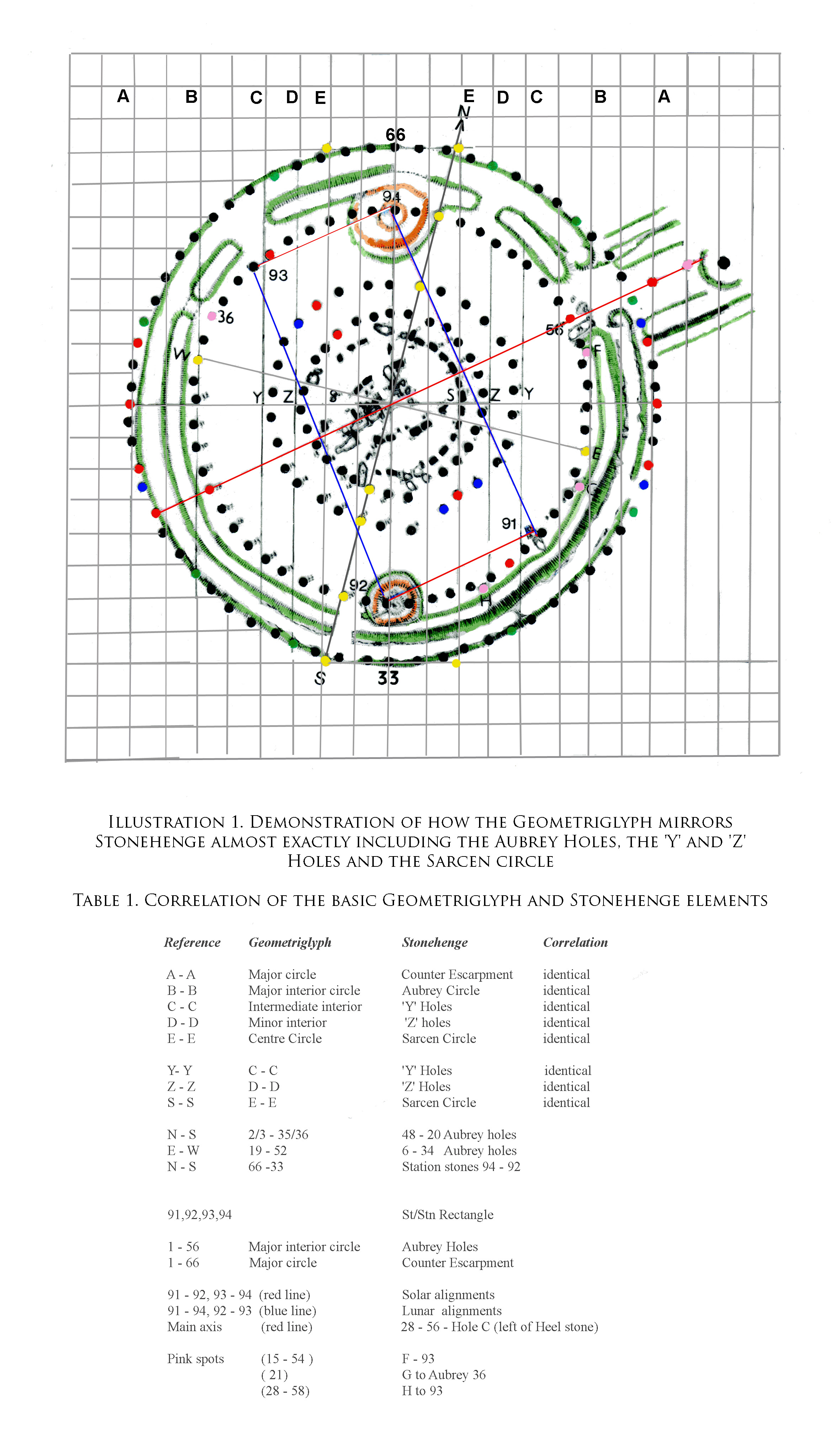
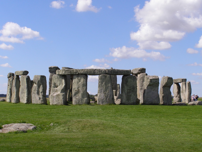
We left NascoBlog12 last January in the middle of the discussion "Just how old is the 'Geometriglyph'? We had arrived at a date between 1100 BC and 800 BC but then some comparative research showed a strange anomaly; alignment of a Geometrigyph template over the ground plan of the famous Stonehenge Monument, in the UK, threw up some quite remarkable coincidences.
When the Summer Solstice Sunrise azimuthal, i.e the alignment running due N.E from the Geometriglyph's centre point - was superimposed over the same on a ground plan of the Stonehenge Monument, one could not help but notice a number of intriguing coincidences which you can see deliniated on Illustration 1 and Table 1, above.
Notice how the N - S meridian of the Geometriglyph (Stations 66 - 33) conjoins exactly Station Stone 94 to the opposite Station Stone 92; the alignment also being a diagonal of the Stonehenge Station Stone Rectangle. Respective N/S meridians were approxiamately 13.5º apart.
This is how I discovered that the Geometriglyph cannily mirrors the 'Station Stone Rectangle' where the solsticial sun and maximum moon extremes align at an (almost) exact right angle - the only place in the world where such a unique phenomenum occurs. How on earth did the Old World architects of the Geometriglyph calculate this event occurs only at the exact latitude and longtitude of a place on the map that we in the modern world call 'Stonehenge'. Why was this remote spot, so far away in the New World, special to an ancient civilisation?
It is important to understand that the Station Stones Rectangle will only perform within one half of a degree north or south of the latitude of Stonehenge. Any place else in the World the rectangle becomes a parallelogram; this is what makes its unique placement so mysteriously intriguing. One can readily accept an astronomical reason, but what was the real purpose behind this 'on the spot' meeting of the sun and moon?
Above, I have printed out for you a copy of Illustration 1: Stonehenge overlaid with the basic Geometriglyph's elements which you can see coincide almost exactly to leave one in no doubt that the two are one and the same. To make life easy, I have added Table 1 of the essential coincidentals.
Here I must emphasise that I am not saying that Egyptians, Phoenicians or even the ancient Greeks actually 'constructed' this stone henge. To the best of my knowledge there is nothing in the archaeological record that supports a massive 'Old World' led enterprise. What I am setting out to prove is a form of metrology based upon pure geometrics and a universal unit of measurement, spread on an international scale from at least 4000 BC and it was this (stone circle) design facility that was subsequently 'imported' into an Early Neolithic - Bronze Age, Britain. More about this in NascoBlog14.
Let us pause for a moment to complete answering the topic question - the age of the Geometrigylph? Its almost unquestionable relationships with Megalithic structures down through the Ages from the time of the Pyramids of ancient Egypt (even the slope length of the Great Pyramid of Giza and the radius of the Geometriglyph are inter-related) to Stonehenge (2800 BC), suggests a life span circa 4000 BC unto, perhaps, the final elaboration of the Nasca/Palpa Geoglyphs which had almost certainly drawn to a close by AD 690 due to extensive desertification ("Portraits of the Gods" Nascodex Publications 2010). A time scale stretching back some 5000 years.
Interactive question: Now here is your interactive question: Bearing in mind the date of Stonehenge Phase1 (circa 2800 BC) and the arrival of 'overseas' Traders for gold and tin to south west Britain; Do you think this had any influence on the choice of location for the Stonehenge Monument. If so, what?
Next month's NascoBlog14 will examine more relationships between the Geometriglyph, Stonehenge and other major stone circles of the UK in an attempt to answer the question," So, just who did build Stonehenge"?
Till we meet again, All Best Wishes and I look forward to some interesting answers to the interactive question.
There is still time to ORDER your copy of "Portraits of the Gods". Please Click the ORDER BUTTON.
William James Veall
NascoBLOG 12
14/01/14 07:49
Author: garethwiscombe Source
GREETINGS AND A VERY HAPPY NEW YEAR 2014 TO YOU ALL
NascoBlog12 is my first of the New Year 2014 and continues with more exciting news about the capabilities of the 'Geometriglyph'.
Remember last year I explained that this fascinating device had a built in facility whereby linear measurement could be used to calculate the volume of solids or liquids. Yes, you read it correctly - using a tape measure to determine the liquid content (wine?) of a vessel. Solids are easy because we can measure (a box) linearly and simply multiply to obtain the internal volume.
I have been asked a number of times since, how a tape measure could possibly indicate the volume of liquid in a vessel ? So, here is a short explanation minus mathematics.
So firstly, have quick look again at the Geometriglyph diagram in NascoBlog10. Here you see both rectangular and circular shapes set within a rectilinear compartmental grid. The' inventors' used the edges of the rectangle as linear units and then integrated the spherical (circumferencial) units; the resulting 'Celestial Constant' (5.4545) was the common, universal factor which could be employed to express both units of length as well as volumetric capacity.
NOTE: Anyone interested in studying this subject further, I recommend the excellent research report : PLOS one. An Ancient Relationship between Units of Length and Volume Based on a Sphere. (Zapassky, Gadot, Finkelstein and Benenson. March 28th 2012. Available on-line)
NOTE: Not wishing to be accused of plagerism, I would like to make it clear that whilst I extrapolated the single unit, linear/spherical relationship back in 2002, the above Report considerably strengthend the evidence I had previously uncovered that Greco-Phoenicians may have used a common measuring unit to survey and construct the Nasca Lines..
Another question came up recently: So, just how old is the 'Geometriglyph' since you throw open the statement that the device, seemingly, has roots going back to the ancient Minoan Civilisation, 2700 B.C. - 1500 B.C.?
A very interesting question which I cannot answer fully in a relatively short NascoBlog, however, I promise all of the relevant evidence will be put in front of Readers in the follow-on series of NascoBlogs. So briefly...
a) The Geometriglyph is located on a rocky hillside overlooking the Nasca Lines. Most historians now agree the geoglyphs were possibly in an advanced state of elaboration, circa 800 B.C. There is nothing to suggest that the 'Mandala' is not part of the the Nasca Lines.
b) My research confirms the Nasca geoglyphs were constructed according to astronomical phenomena. The Geometriglyph mirrors this astronomical/geoglyphic relationship, thus the device must also date circa 800 B.C. I believe the Geometriglyph was 'constructed' at its location as a vital surveying tool, not 'invented' on-the-spot for the purpose in hand.
c) The device also mirrors the celestial targets hypothesised for both the Linear Observatory and the vast Landscape Planetarium in the Southern Andes Mountains. (Portraits of the Gods, Nascodex Publications. 2010) The presence of Phoenician inscriptional material at each of these sites allows one to extend the predictive hypothesis to a date between 1100 B.C. (earliest known date for the Phoenician alphabet) and 800 B.C.
However, at this juncture we run into a major anomaly:
d) When I made a comparison between the Geometriglyph and an official ground plan of Stonehenge, not only was there the usual strong correspondence between solar and lunar phenomena but something truly amazing occurred; aligment of the summer solstice sunrise azimuthal exposed Stonehenge's infamous 'Station Stone Rectangle' clearly deliniated within the Geometriglyph's matrix.
Tempted to go a stage further, I found an almost exact coincidence between the 'stone circles' within the Geometriglyph to those within Stonehenge, for example, the Aubrey holes, the 'X' and 'Y' holes and even the Sarcen circle. Next month's NascoBlog13 will include a diagrammatic representation of this remarkable new find and how it was hiding a template of the Great Pyramid of Giza.
Can then the Geometriglyph really be as old as the Pyramids and Stonehenge, 2800 B.C. and beyond? We know for certain who built the Pyramids of Egypt but did these people also design and then help to build Stonehenge, and more important, Why?
Meantime, Good Luck and Very Best Wishes to You All.
There is still time to ORDER your copy of "Portraits of the Gods". Please Click the ORDER BUTTON.
William James Veall
NascoBLOG 11
28/11/13 21:37
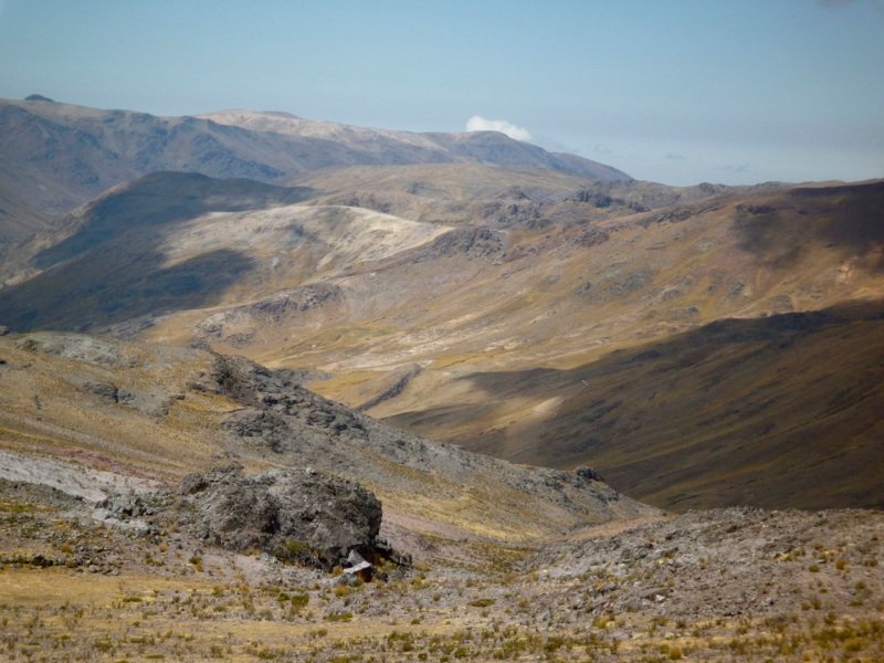
Image (c) WILLIAM JAMES VEALL
Greetings to you all. Welcome to NascoBlog11.
Firstly, a note of apology. Due to a computer glltch after installing new software, it has been necessary to remove the originals and reissue NascoBlogs 10 and 11.
So, to continue from NascoBlog10 The 'Geometriglyph' may have not only been designed for archaeoastronomical surveying but the inherent 'Celestial Constant' (5.4545) appears to allow it to express linear lengths in terms of a 'Universal Unit of Measurement'. For example, convert an ancient linear measurement into a metric equivalent, divide by the celestial constant, the result will be expressed as an almost exact 'Phoenician' 'Universal Unit'.
It is therefore a small step to create a standardised linear measuring rod or flexible 'tape measure'. Well, it turns out that the Egyptians, for example, calculated the volume of liquid in standard rounded vessels (wine) by measuring the major circumference. So, now we have the Geometriglyph measuring volumes!
https://english.tau.ac.il/news/measuring_system
In my humble opinion, forget about 'elbow to thumb', 'size of the King's left foot' or any of the other weird notions concerning the world's invention of units of measurement. Advanced, sophisticated societies would not have tolerated such a plethora of juxtaposed systems of measurement ("The King is Dead. Long live the King - with his larger/smaller left foot !!”). Units would have to be to a precise linear, spherical or volumetric standard of measurement.
The one great universal constant the world over is the Heavens. Eternal ancestral home, ever changing, but never changing. Constant through all eternity. Units created from the Heavens transmuted for use on earth.
To learn more about this remarkable device log on to:
http://www.nascodex.org/NX/Geometriglyph.html
The "Lost island of Atlantis": To recap, in NascoBlog9 we put all the evidence in place to prove that "Atlanteans" from the Mediterranean journeyed to, and took up residence, in the Andean Highlands of Peru and created a "Kingdom of the Dead" and "Highway of the Dead".
I will now put in place the last piece of the puzzle to one of the World's great mysteries: If my foregoing hypothesis about Atlantis was true: I had to prove those self-same Peoples from the Mediterranean carved the mass of inscriptive material and multi-racial human head figurals and not the indigenous Indians.
The indigenous population at the time were basically illiterate having no form of known written communication whatsoever between themselves, let alone produce hundreds of inscriptions using 'Phoenician' characters. I doubt very much they could have compiled the vast Scriptorium which is entirely enscribed in Phoenician.
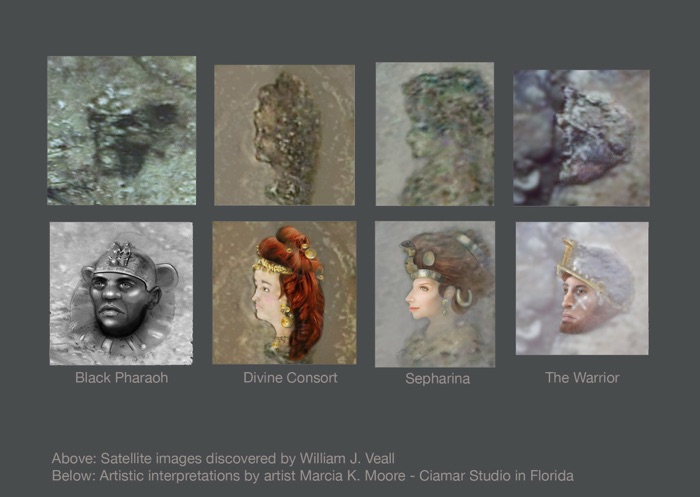
Further, the human busts exhibit no trace of indigenous Indian physiognomy; they are classic Greco-Roman, Arabic or Syrian, Chinese or Hindu. Others have the appearances of being not Negroid but Black-African.
Finally, neither the Nasca Culture nor any other of the indigenous tribes, had - or indeed exhibited - the scientific or mathematical knowledge to construct sophisticated archaeological monuments like the Nasca LInes, the huge Landscape Planetarium or the Southern Andes Linear Observatory. Nor to cartographically plan and execute a 300 kilometre "Great Highway".
(See Portraits of the Gods. Nascodex Publications 2010).
Thus, from the foregoing evidence and its early chronology, it is clear Peoples from the Old World Civilisations MUST have brought this knowledge into Peru and among those Peoples the main protagonists were the Phoenician - Canaanites from the Lebanon who eventually remained in residence for nearly 800 years.
NascoBlog11 is the final NascoBlog for 2013. I hope sincerely that you have enjoyed travelling along one archaeoastronomers' road of discovery. For me it has been an incredibly, intensive, but exciting and, may I say modestly, successful Year 2013 culminating in the discovery which suggested the 'Continental Island' of South America was indeed the 'Long Lost Island of Atlantis'.
Further, the long held, much venerated belief that Columbus discovered America was blown completely out of the water (s'cuse the pun) by massive evidence from the Phoenician's 'New World Kingdom' ("Portraits of the Gods". Nascodex Publications. 2010) which they, and their multi-racial counterparts, occupied in the Southern Andes of Peru for 800 years, or more. Thus, I was able to confirm the long held Diffusionist's belief that Trans-Oceanic Peoples from the Mediterranean were the first to set foot in the Americas, 3000 years BEFORE Christopher Columbus.
I am very hopeful that in the coming New Year a transliteration of some of the inscriptive material discovered will devolve a new name for us to celebrate as the true discoverer of America and in turn put their country of origin into the history books - or until the next time - an archaeologists' trowel or passing satellite pauses in a new act of discovery.
A VERY HAPPY CHRISTMAS AND PEACEFUL NEW YEAR 2014 TO YOU ALL
There is still time to ORDER your copy of "Portraits of the Gods" in time for Christmas, please Click the ORDER BUTTON.
William James Veall
NascoBLOG 10
13/11/13 21:34
Image (c) WILLIAM JAMES VEALL
Hello and welcome to this re-issue of NascoBlog10. 13th November 2013.
Firstly a note of apology: Owing to a computer glitch after installing new software, it is necessary to reissue this NascoBlog10. Para 9 and 10 contained co-ordinate errors and has been removed for correction. The item will be carried over to a NascoBlog in the New Year.
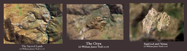
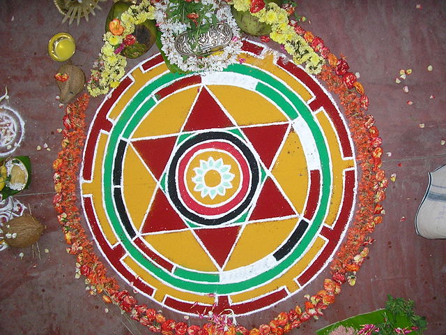
Back to the topic. Last week I introduced a rather special Figural in the foothills of the Nasca Pampa called a 'Mandala' and how I had analysed and tested this geometrical geoglyph and found it was importantly associated with the 'Lines' and as such helped to prove they were constructed in accordance with astronomical phenomena.
The first stage in constructing my 'Mandala' - which I call a 'Geometriglyph' - was to reproduce an acccurate copy of the figural from an aerial photograph which presented a measure of difficulty because the geoglyph is sited on a sloping, irregular, rock- face.
For your interaction this week: log-on to Google Earth, enter the co-ordinates Latitude 14 38 38S. Longtitude 75 10 16W to view and explore the 'Mandala' for yourself. Notice its closeness to the Nasca Lines Display opposite.
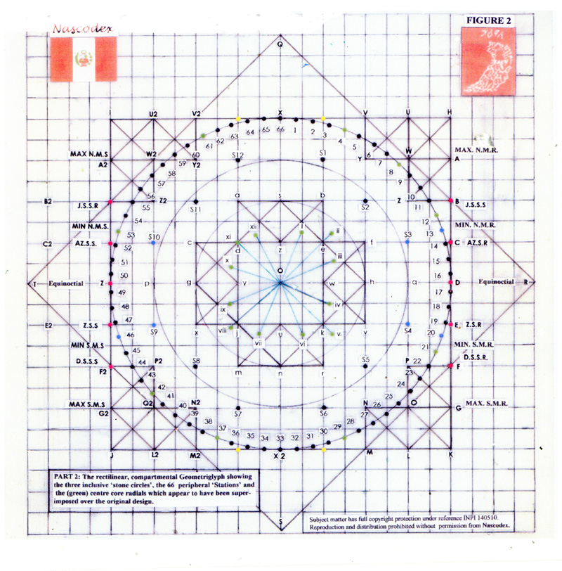
I have not included in NascoBlog10 the intricate geometry or astronomy behind the construction of the 'Geometriglyph' so have kept the text purely descriptive. Firstly, note that the rectilinear, compartmental Geometriglyph comprises of two rectangles, rotated 90º to each other. There are three stone circles, an inner core circle which contains a number of small radials, an intermediate circle and a large outer circle. The sides of the core rectangle are set tangential to the outer circle. Ignore for now the inner circles, radials, grid lines and corner compartments.
For the moment we will concentrate on the Geometriglyph's outer circle because it has a most unusual feature. The circle is divided by 66 stone markers. Sixty six seems at first glance to not only be an observational error on my part, but a quite inconvenient rather random number. Each numbered circumferencial division is equal to 5.4545 º; this number, which I call the 'Celestial Constant', has proven to be truly unique. (I will explain in NascoBlog11)
(The Minoan Civilisation, 2700BC - 1500BC (Bronze Age)) allegedly produced a disc shaped bronze calendar which automatically corrected the imbalance between the calendar year (365 days) and a solar (seasonal) year of 365.2422 days. Unfortunately, no record exists as to how the disc automatically intercalated the extra day every fourth (leap) year.
(Butler, A. 'A Bronze Age Computer Disc’. Quantum. Mar. 1999).
However, to continue. I decided to stick with the '66' anomaly and project diagonals through the Geometriglyph's centre point. Hey presto! The figural recorded solstices, equinoxes, the zeniths and anti-zeniths and lunar maxima and minima cycles. Also certain first magnitude stars, and even the beautiful Pleiades constellation.
I cross -checked the Geometriglyph over many Nasca Lines' features: long and short geoglyphic lines, zig-zags (proving in the process that they could/were used as Linear Observatories), trapezoidal, triangular and rectangular areas, Line centres (after Aveni), ceques (after Zuidema) and many of the well known figurals, the Monkey, Killer Whale, Hummingbird, the Snakebird (Cormorant) and the Spider, to name just a few.
Apart from my Nasca Lines research; this remarkable astronomically constructed device was utilised during my research and subsequent discovery of the Southern Andes Linear Observatory and the vast Landscape Planetarium, 4.500 metres above sea level, in the Peruvian Andes Mountains.
"Portraits of the Gods". Nascodex Publications. (Click below to Order)
In truth, the device is so versatile I have used it to analyse pyramids, tombs and temples, and many stone circles like Stonehenge and Avebury in the UK along with other edifices across the archaeological world. As a guide for architecture suspected of being constructed in accordance with celestial phenomena the Geometriglyph has proved invaluable. It was this 'international' feature which strengthened my convictions that the Nasca Culture did not construct the basic Nasca Lines.
Note: The Geometriglyph has full International Copyright Protection under Registration Code INPI 140510 and must not be reproduced by any means whatsoever without written permission from Nascodex or the author, William James Veall.
In NascoBlog11 you will learn how the 'Celestial Constant' formed basic 'Units of Measurement' for transposing on to linear rods or 'tape measures' and how it may have been used for calculating the volume of liquid (wine) in a vessel:
https://english.tau.ac.il/news/measuring_system
I will tell you more about this exciting discovery in NascoBlog11 on the 28th November 2013. and, as promised, how it weaves together my hypothesis that South America is the true "Long Lost Island of Atlantis".
Be with you all again on 28th November 2013.
Your copy of "Portraits of the Gods" can be easily obtained by Clicking the ORDER BUTTON . Thank you.
William James Veall
Hello and welcome to this re-issue of NascoBlog10. 13th November 2013.
Firstly a note of apology: Owing to a computer glitch after installing new software, it is necessary to reissue this NascoBlog10. Para 9 and 10 contained co-ordinate errors and has been removed for correction. The item will be carried over to a NascoBlog in the New Year.
Back to the topic. Last week I introduced a rather special Figural in the foothills of the Nasca Pampa called a 'Mandala' and how I had analysed and tested this geometrical geoglyph and found it was importantly associated with the 'Lines' and as such helped to prove they were constructed in accordance with astronomical phenomena.
The first stage in constructing my 'Mandala' - which I call a 'Geometriglyph' - was to reproduce an acccurate copy of the figural from an aerial photograph which presented a measure of difficulty because the geoglyph is sited on a sloping, irregular, rock- face.
For your interaction this week: log-on to Google Earth, enter the co-ordinates Latitude 14 38 38S. Longtitude 75 10 16W to view and explore the 'Mandala' for yourself. Notice its closeness to the Nasca Lines Display opposite.
I have not included in NascoBlog10 the intricate geometry or astronomy behind the construction of the 'Geometriglyph' so have kept the text purely descriptive. Firstly, note that the rectilinear, compartmental Geometriglyph comprises of two rectangles, rotated 90º to each other. There are three stone circles, an inner core circle which contains a number of small radials, an intermediate circle and a large outer circle. The sides of the core rectangle are set tangential to the outer circle. Ignore for now the inner circles, radials, grid lines and corner compartments.
For the moment we will concentrate on the Geometriglyph's outer circle because it has a most unusual feature. The circle is divided by 66 stone markers. Sixty six seems at first glance to not only be an observational error on my part, but a quite inconvenient rather random number. Each numbered circumferencial division is equal to 5.4545 º; this number, which I call the 'Celestial Constant', has proven to be truly unique. (I will explain in NascoBlog11)
(The Minoan Civilisation, 2700BC - 1500BC (Bronze Age)) allegedly produced a disc shaped bronze calendar which automatically corrected the imbalance between the calendar year (365 days) and a solar (seasonal) year of 365.2422 days. Unfortunately, no record exists as to how the disc automatically intercalated the extra day every fourth (leap) year.
(Butler, A. 'A Bronze Age Computer Disc’. Quantum. Mar. 1999).
However, to continue. I decided to stick with the '66' anomaly and project diagonals through the Geometriglyph's centre point. Hey presto! The figural recorded solstices, equinoxes, the zeniths and anti-zeniths and lunar maxima and minima cycles. Also certain first magnitude stars, and even the beautiful Pleiades constellation.
I cross -checked the Geometriglyph over many Nasca Lines' features: long and short geoglyphic lines, zig-zags (proving in the process that they could/were used as Linear Observatories), trapezoidal, triangular and rectangular areas, Line centres (after Aveni), ceques (after Zuidema) and many of the well known figurals, the Monkey, Killer Whale, Hummingbird, the Snakebird (Cormorant) and the Spider, to name just a few.
Apart from my Nasca Lines research; this remarkable astronomically constructed device was utilised during my research and subsequent discovery of the Southern Andes Linear Observatory and the vast Landscape Planetarium, 4.500 metres above sea level, in the Peruvian Andes Mountains.
"Portraits of the Gods". Nascodex Publications. (Click below to Order)
In truth, the device is so versatile I have used it to analyse pyramids, tombs and temples, and many stone circles like Stonehenge and Avebury in the UK along with other edifices across the archaeological world. As a guide for architecture suspected of being constructed in accordance with celestial phenomena the Geometriglyph has proved invaluable. It was this 'international' feature which strengthened my convictions that the Nasca Culture did not construct the basic Nasca Lines.
Note: The Geometriglyph has full International Copyright Protection under Registration Code INPI 140510 and must not be reproduced by any means whatsoever without written permission from Nascodex or the author, William James Veall.
In NascoBlog11 you will learn how the 'Celestial Constant' formed basic 'Units of Measurement' for transposing on to linear rods or 'tape measures' and how it may have been used for calculating the volume of liquid (wine) in a vessel:
https://english.tau.ac.il/news/measuring_system
I will tell you more about this exciting discovery in NascoBlog11 on the 28th November 2013. and, as promised, how it weaves together my hypothesis that South America is the true "Long Lost Island of Atlantis".
Be with you all again on 28th November 2013.
Your copy of "Portraits of the Gods" can be easily obtained by Clicking the ORDER BUTTON . Thank you.
William James Veall
NascoBLOG 9
23/10/13 09:30
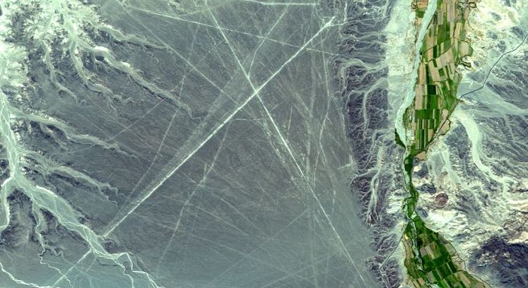
Image (c) NASA/GSFC/MITI/ERSDAC/JAROS, and U.S./Japan ASTER Science Team
Welcome to NascoBlog9. 23rd October 2013.
Continuing the theme of NascoBlog8, I said I would tell you how I deduced that virtually all the major features of the Nasca Lines were constructed to accord with celestial phenomena - cycles of the sun and the moon and align with certain first magnitude stars like Sirius, Vega, Arcturus, Capella and Rigel, just to name a few off the cuff. One must also not forget constellations like the Pleiades and Orion.
Many hypothesise that the Nasca Lines are a huge astronomical atlas whereby figurals, like the whale, the monkey, the hummingbird and the spider, for example, were designed to accord with certain constellations. However, when you have a zillion stars above your head you can 'draw' any shape you wish depending upon the degree of your imagination and beliefs.
In truth, as far as the Nasca Lines are concerned, we do not really know for sure which group of stars the builders may have used to represent a particular figural - and,of course, the reasons behind that selection. As an example, many believe the wonderful constellation Orion is depicted in the monkey geoglyph, but which culture laid out the monkey in the first place, and why?
It is now generally accepted that certain major lines which pass through figurals are without question aligned with extreme events like the Winter or Summer Solstice. However, in developing my own version of the 'Mandala', which I call a 'Geometriglyph', I was able to analyse virtually any line within the Nasca Lines palimpsest to determine whether it coincides with a particular celestial event.
There is no question whatever, the Nasca Lines are constructed to a celestial formulae based upon astronomical phenomena. By the same token: this discovery led to my derivation of the 'celestial constant' of 5.4545. (I will tell you about this constant next time). I was able to successfully analyse major and minor azimuths, rectangles and trapezoids, triangular geoglyphs, even the construction of individual figurals and zig-zag geoglyphs (Linear Observatories) and in almost every case hit a horizon target which correlated very closely with published astronomical tables.
After taking more than just a few hundred 'readings', I am still constantly amazed at the pin- point precision of this astronomical palimpsest. Bear in mind the Nasca Pampa is no smooth, flat blackboard as many visualise, but lines run arrow straight across 500 square kilometres of undulating, pebble strewn terrain scarred by rocky outcrops, dried up river beds, hollows and small hills.
I challenge any team today to produce even 20 square kilometres of 'Nasca Lines' based around a current Nascan sky scenario. Sorry, no modern survey tools, electronic assistance, or astronomy tables, etc. Oh, and you will need around a hundred years,or so, to verify your solar and lunar cycles, plus you have to rememember your star lines will move 1º after 72 years! Good Luck.
Sorry folks, my Media CEO tells me I have outrun my NascoBlog space today so I promise I will update you with 'Atlantis' news next time, as well as explaining more about the Geometriglyph and, of course, the built - in 'celestial constant'.
See you again with NascoBlog10 on the 6th November 2013
Don't forget, the more NascoBlogs you read, the more you will want a copy of "Portraits of the Gods", please just CLICK the ORDER BUTTON.
William James Veall
NascoBLOG 8
10/10/13 21:25
This image is into the public domain. Author Nharipra
Hello again everyone and welcome to NascoBlog8
I promised in NascoBlog7 to explain why in my opinion the now infamous archaeological monument called the Nasca Lines was constructed in accordance with astronomical phenomena - inspite of the fact that there is much opposition to this idea.
Anyone from their armchair at home can relatively easily 'google' many of the major lines spread across the Nasca palimpsest and discover which align with azimuths of solar, lunar or even first magnitude stars.
To help with research, Dr Anthony Aveni, Russell Colgate Professor of Astronomy and Anthropology, Colgate University, kindly sent me a copy of his excellent 'Astronomical Tables intended for use in Archaeoastronomy Studies: Aveni A, 1972. American Antiquity 37: 351- 540 ; these I have used countless times and I express my grateful thanks to Dr Aveni. I thoroughly recommend the tables to any budding Archaeoastronomer.
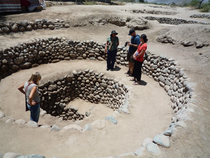
I also have to thank for assistance, in those far off, early days of my investigation into the Nasca Lines, Dr Ana Maria Cogorno, Albacea de Maria Reiche, Lineas y Geoglyphs de Palpa y Nasca, who helped me to locate a relatively unknown Geoglyph nestling in the Andean foothills and which overlooks the Nasca Lines. Quaintly referred to as the 'Mandela' this geoglyph provided the basis of my own interpretation which I subsequently termed, a 'Geometriglyph'.
Instead of posting a photograph, I have only quoted its co-ordinates so that you can interact with my NascoBlog8 by 'googling' to the site. You must, by the way, have a version of Google Earth installed. The co-ordinates for the 'Mandela' are Latitude 14º 38'' 38' S and Longtitude 75º 10'' 16'' W.
Since being brought to the notice of the scientific fraternity the 'Mandala' has gradually become recognised by a few as an essential ingredient of pre-Columbian Peru's astronomical pre-history. More especially because of its closeness to and therefore suspected astronomical relationship with the Nasca Lines.
In my opinion the two are directly related and in the next Nascoblog9 I will explain the reasons. Meantime, please, do have a look at the 'Mandela'. If by chance you do not have Google Earth installed on your computer you can log on to http://www.google.co.uk/earth/index.html where you have access to the original Geometriglyph story.
See you all again on the 23rd October 2013 for NascoBlog9 where I will also give you some really exciting news in respect of the 'Atlantis' story we ran in NascoBlogs 1 - 7.
To Order your copy of "Portraits of the Gods" simply Click the ORDER BUTTON .
Thank you and Enjoy.
William James Veall
NascoBLOG 7
25/09/13 20:55
Visiting a typical puquio at Cantalloc (Nasca) with Dr.Ana Maria Cogorno (centre) (c) William James Veall
Hello Everyone, Welcome to NascoBLOG7. I guess we can now settle down to the run into Autumn. Autumn, I hear you say - what already?
Yes, how the year has flown by and what great progress we at Nascodex have made in the last six to eight months, both in our current research programmes and publication of "Portraits of the Gods" supported by NascoBLOGS 1-6.
The sudden and almost unexpected link between "Portraits" and one of the World's last great mysteries, "The Long Lost Island of Atlantis", is certainly one of the great highlights of the year so far.
To find the 'Lost Lands of the Phoenician Canaanites' in Peru was a tremendously exciting achievement and a canny piece of detective work, but, to discover that we were actually sitting atop the 'Island of Atlantis' was, to say the least, unbelieveable!
In this next series of NascoBLOGS I am going to describe some of my past research which overlaps and supports much of the work that eventually led to uncovering not just a Phoenician, but a multi-cultural society living permanently in Peru 3000 years ago.
Obviously, with the space limitations of a Blog I cannot write complete chapter and verse on each individual 'discovery' so I will keep the text short and sweet and add some illustrations and photographs. Plus, you will get up to date News Items as they happen.
Phoenician Inscription on the Nasca Lines
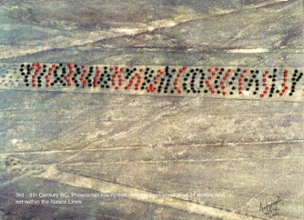
The first positive evidence found that a footfall from an Old World Civilisation had stepped into the New World was my discovery of a massive 300 metre long Inscription 'written' in 3rd - 4th century B.C. PHOENICIAN; this to much excitement, was actually translated by a specialist Epigrapher, Dr Clyde Winters, who still posts the inscription on his web-site to this very day.
Here is the highlighted version of the actual inscription discovered in August 2002 and the subsequent translation. For a full explanation you can either look-up the article in "Portraits of the Gods", or log on click here .
As this dateable artifact is set neatly on a trapezoid within the Nasca Lines, it is one of the major clues we have giving a positive date for the construction of the Nasca Lines. Although, admittedly, the 'message' could have been placed along a vacant trapezoid sometime between 400 - 300 B.C. with the trapezoid itself being elaborated much earlier, say, 6th - 5th century B.C. At least, that is preferable to the 10,000 B.C. date extolled by some cranks who call themselves historians!
Still on the same subject, what do you think of the magnificent image of the ‘Architect of the Nasca Lines' depicted in "Portraits of the Gods"? This is the very first realistic 'photograph' taken of any actual human being that may have worked on the construction of the geoglyphs. Please drop me an e-mail and let me have your opinion. Thank you.
Please make a note that our next NascoBlog is the 9th October 2013 when I will discuss why I believe the Nasca Lines were constructed by means of astronomical phenomena - when many leading authorities still refuse to accept the fact.
William James Veall
NascoBLOG 6
11/09/13 20:44
Phoenicians ‘Heaven on Earth’ Photography (c) William James Veall
Hello Everyone. Welcome to NascoBLOG6.
I hope you all had a wonderfully refreshing vacation. How many of you went to Peru, or even to the Lebanon, the Home of the Phoenician-Canaanites?
Today, we finish this particular series of NascoBLOGS by asking; What is the real truth behind that Utopian Paradise, named by the Ancient Philosophers, 'Atlantis'?
Past NascoBLOGS have quite clearly proven the long term presence of Old World Civilisations living peacefully together in the Southern Coastal regions and High Altiplano of Peru, at least between 1200 B.C. to 400 B.C. However, as I predicted in the "Portraits" time- frame, SeaFarers were certainly in Peru circa 2200 B.C.
Also, my time- frame coincides with the Greek historical dialogues, suggesting a 1200 B.C.- 400 B.C. time-line is realistic:
12th Century B.C. Trojan War. Invention of the Phoenician alphabet. (1150 B.C.)
8th Century B.C. Homer and the Odyssey. (850 B.C.)
7th Century B.C. Solon. (638 B.C.)
5th Century B.C. Herodotus. (450 B.C.)
4th Century B.C. Plato. (385 B.C.)
Herodus was quite explicit about the fact that Homer 'lived' 400 years before him. Plato states that 'Atlantis' existed 9000 years before His time; this I corrected to 1150 B.C. (NascoBlog5) by assuming Plato's 'years' were probably derived from a lunar calendar, i.e. 9000 months instead of years.
Greek history is immensely complex, much of it being confused by mythological overtones, nevertheless, I believe there is a thin grain of historical truth running through the early dialogues which allows me sufficient latitude to present a positive case for Voyagers being able to reach 'Atlantis' on a continuous commercial basis.
So taking a purely commercial line of attack: in my opinion, trade was taking place between the Old and New World Civilisations long before the Greek dialogues, long before even the Trojan War. I believe it was at a point, circa 1200 B.C., for socio-politico-economic reasons, the story of 'Atlantis' imploding was invented as 'dressage' to protect alliances with South America.
But is this the whole truth?
Of the many satellite photographs I have captured and examined minutely there is not one single sign of destruction by volcanic eruption or even from 'a conquerer's mauls'. Every image is in almost original pristine condition even after nearly 3000 years of natural mountain top and desert erosion. Stranger still, there are no signs of elegant residential architecture, no halls or palaces or temples - just bundles of near ruinous, stone built, 'hutments'. A truly monastic existence.
That said, the satellite evidence does in a sense appear to support Plato and Homer, but we need to read between the lines; "a great and virtuous island where its Peoples (the Atlanteans) live in a paradise of peace and loving harmony".
In "Portraits of the Gods" I have hypothesised Priest -Gods may have exploited commercial revenues to achieve a long held ancestral dream; the creation of a 'Heaven on Earth' which would not only become a depository for knowledge Man had accumulated over, perhaps, countless millenia, and, even watched over by the very ancestors who had controlled the wealth, power and sources of this wisdom, depicted by the human head intaglios.
A colossal library of inscriptive story boards indelibly imprinted into the very heart of the earth, the desert, mountains, hillsides, the valleys and streams. A whole cultural existence set into one indestructable time capsule.
The New World Kingdom has one final but very important question - the real reason behind the colossal "Temple of the Sacred Lamb" portal. A Ram is, perhaps, not an unusual choice of icon for the then 'Age of Aries', but I believe the Ram played a much more integral role in the creation of the Atlantean 'Heaven on Earth' than one can possibly imagine.
The whole palimpsest is indicative of an embryonic form of 'Christianisation' being developed and practised secretively by a multi-racial Cult; this surely gives a rock solid reason for the necessity to invent an extremely elaborate cover-up story; "'Atlantis' was a great and virtuous island where its Peoples (the Atlanteans) live in a paradise of peace and loving harmony”.
There is no question, this was Homer's 'Kingdom of the Dead ' and the statue lined "Great Highway"; his 'Highway of the Dead.' South America is the 'Continental Island' the Ancient Priests called, 'Atlantis'.
Our next NascoBLOG7 is on the 25th September 2013.
Meantime, I hope you found my NascoBLOGS 1 - 6 of interest and are able to complete the series by adding them to your own copy of "Portraits of the Gods".
If not, please do not delay, obtain a valuable 'First Edition' copy by simply 'Clicking' the ORDER BUTTON .
William James Veall
NascoBLOG 5
28/08/13 20:39
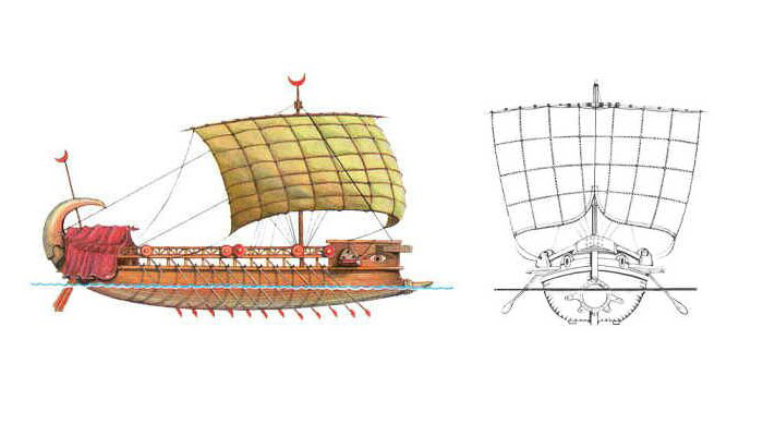
Phoenician Ship Image (c) www.oocities.org
Hello and as always, a warm welcome to NascoBLOG5
As promised; here is the follow up to NascoBlog4 supporting my statement : 'a Phoenician presence in South America is now indesputable'.
We saw in NascoBLOG4 positive evidence of Phoenician activity in South America because of the abundance of inscriptive material; this week we offer more proof using artifactual evidence, for example
a) The 'Phoenician Kingdom' covered a massive 42,000 sq,kms (26,000 sq.miles).
b) Contains six major archaeological sites: Memorial Plaza, a Scriptorium, a Planetarium and Linear Observatory, a Temple and an amazing 300 kilometres "Great Highway" lined with sculptures and geodetic 'signposts'.
c) A huge Chinese and a Greek effigy enscribed within the Nasca Lines - suggesting multi-racial team-work was involved in the creation of the Nasca Lines.
d) The huge number of human face intaglios depicting differing races of Peoples together with 'Greek' Gorgon effigies.
e) The intermix of human face imagery confirms a multi-racial Cult living together in harmony.
f) No shred of evidence of indigenous influence - from the Nascas, for example.
g) No physical evidence that the 'Kingdom' was ever conquered.
h) Complete absence of major domestic, social or religious forms of architecture - only a plethora of closely grouped, ruinous and unappealing 'hutments'.
i) Many circular and rectangular stone built structures, some marked internally with Phoenician characters.
j) Advanced knowledge of astronomy and navigational expertise reflected across the whole spectrum of the various constructions.
Having presented inscriptive material together with artifactual evidence we can say without contradiction that not only Phoenicians, but other Caucasians, Peoples from the Near, Middle and Far East, India and China had been living in and trading with South America more than 3000 years BEFORE Christopher Columbus, allegedly, made his 'discovery' of America in AD 1492.
In NascoBLOG6, we will conclude the series by considering why Herodotus, Plato and Homer may have deliberately misconstrued and glorified the facts surrounding the 'missing' Island of Atlantis'.
Please CLICK the ORDER BUTTON below to immediately obtain your copy of "Portraits of the Gods" incorporating the 'Lost Lands of the Phoenician-Canaanites… in Peru.
See you all again on the Wednesday, 11th September 2013.
William James Veall
NascoBLOG 4
14/08/13 20:35
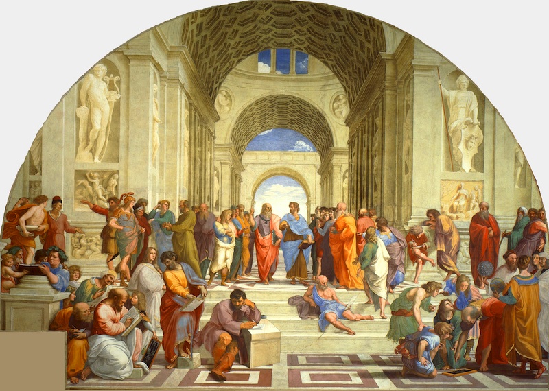
Artist: Raphael 1483-1520 Title: The School of Athens
This work is in the Public Domain.
Hello and Welcome to NascoBLOG4,
I hope you enjoyed swotting up on Plato and Homer's 'mythological' stories and formed an opinion about the long lost Island of 'Atlantis'.
I appreciate the summer holidays are in full swing, so many of you may not have been able to tear yourselves away from sun drenched beaches and golden sands so, here is a very brief resume of 'Atlantis' history to help you catch up.
A Brief History of 'Atlantis'
The earliest known mention of 'Atlantis' appeared around 380 B.C from two of Plato's dialogues: TIMAEUS and CRITIAS acquired from a much earlier dialogue passed on to Solon (638 B.C.) by Egyptian Priests.
Subsequently, there have been many locations and versions of 'Atlantis. Some exotically fanciful, others with tales extolling the wondrous virtues of a secret Island paradise having a very advanced, politically stable, Utopian society. As that most respected ancient Greek Philosopher, Herodotus, (484 B.C.) reportedly said, "Atlantis was a superior civilisation lost in time".
Plato, (385 B.C.) a Follower of Herodotus, said 'Atlantis' existed 9000 years before his time. However, as most historians and geographers would quickly compute; a 9500 B.C. happening on the scale of 'Atlantis' is historically impossible so this may have been a figure plucked from Plato's deliberately fertile imagination.
However, in fairness to Plato, if he was using an alternative calendar system, say 'months' instead of 'years', his 9000 years would reduce to a reasonably acceptable date circa 1150 B.C. ( 400 B.C. + 750 'months' = 1150 B.C.) which from the point of view of inscriptive material (1150 B.C.) definitely signals a very early entry date of Phoenician Sea Peoples into Peru. ( Veall. "Portraits of the Gods")
Historically, the Phoenicians, became so power hungry they attempted to take over the rest of the known commercial World, only to be conquered at home by the rather more peace loving Greeks (332 B.C.) and who, by the way, were eventually defeated by the all conquering Romans Imperialists at Carthage (146 B.C.).
Very few Scientists, and Oceanographers in particular, have found any physical evidence that Atlantis ever existed and even if there was an island "that exploded with such violent eruption that it tore itself to pieces and sank overnight without trace" - it was NOT Atlantis.
Remember, mythology states that Atlantis was LARGER than Africa and Asia put together ". Now THAT would have been a disaster of such cataclysmic proportions it would have moved the very Pillars of Planet Earth.
If we refer to the 'Phoenicians and their multi-racial counterparts', by the collective name of Atlanteans, the whole story behind my sensational discovery begins to make sense:
Evidence from the Inscriptions and Legends
a) A revised date of 1150 B.C. coincides almost exactly with the invention of the Phoenician's international trading alphabet, circa 1200 B.C.
b) Phoenician style inscriptions are found throughout South America, especially along river trading routes and mining regions.
c) Phoenician inscriptions and legends are recorded in abundance from all the sites portrayed in "Portraits of the Gods", including:
d) the massive 3rd/4th Century B.C. Phoenician inscription on the Nasca Lines.
e) Phoenician inscriptions accompany virtually every intaglio and rock carving described in "Portraits": Human Heads,Gorgon images, Flaura and Fauna.
f) Copius geodetic signatures along the "Great Highway are Phoenician genre.
The arguement for a Phoenician presence in South America is indesputable
In time for NascoBLOG5 please try to obtain a copy of " Portraits of the Gods" because we will continue the evidence which led to the uncovering of one of the World's last great mysteries, the true location of an Island called ATLANTIS.
As August is holiday month for many of you, I am extending the NascoBlog3 question period until the 28th August.
So for now, have a great vacation, speak to you all on the 28th August.
To immediately obtain your copy of "Portraits of the Gods", please 'Click' the ORDER BUTTON.
Thank you.
William James Veall
NascoBLOG 3
26/07/13 20:29
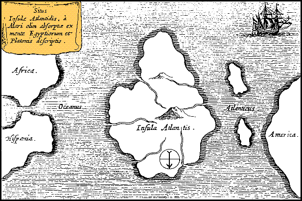
Athanasius Kircher's Map of Atlantis (c.1669). Note that north is at bottom.
Hello again. Welcome to NascoBLOG3
How did you get on with the NascoBLOG2 question? I would like very much to hear the route you chose and what you looked for in the way of evidence of Phoenician activity. Don't forget, Google Earth is a wonderful tool and can make you feel you are actually on expedition. Maybe, you too, will make some new and exciting discoveries. If you wish I will publish them for you on NascoBLOG.
(Please don't forget - all pictures downloaded via G.E. must have a full Attribution in place)
In NascoBLOG2 we touched upon a theme which appears to link Greek Mythology with the discoveries described in "Portraits of the Gods" - either the book or the brief resume' on my Book's Promo video.
Historical background
First and foremost let me give you a little historical background. Phoenicia was a commercially orientated Empire of Sea Peoples who had created new markets world-wide for their goods and raw materials like gold, silver and iron ore, but especially tin which was used in the manufacture of bronze artifacts.
It is recorded historically that the Phoenicians feverishly guarded commercial knowledge from competitors, like the Greeks, and later the Romans after they had conquered the Greek's major trading port of Carthage on the Mediterranean coast.
However, this begs the question; if that's the case, how does one account for finding sculptures (intaglios) of a multi-cultural society memorialised in perfect condition and harmony right across the Phoenician 'New World Kingdom' of Peru, South America, as described in "Portraits of the Gods"?
Please bear in mind that once a transliteration of the many legends and inscriptions becomes available the whole scenario could change overnight.
The Phoenicians in South America
The main occupation and activity period of the Phoenicians and their compatriots in South America seems to have taken place peacefully in the 800 years between 1200 B.C. and a little after 400 B.C; these dates coincide extremely well with Greek mythology, e.g. Plato 1200 B.C. and Homer 400 B.C. running parallel with the chronology of the Phoenicians 'New World Kingdom', as tabled in "Portraits of the Gods".
The theories in NascoBLOG2 (Mattievitch/Mertz/Pellech) hypothesised that the 'myths' related by Homer suggest Odyssey's voyage was a carefully disguised visit to the Andean region of Peru wherein lay the true 'Kingdom of the Dead' and the approach route, the "Great Highway", was Homer's 'Highway of the Dead'.
It is clear from the statements made by Plato and Homer that they were referring to something other than a 'small' island in the middle of an Ocean. They were adamant that the 'Island' was larger than Libya and Africa put together. They were, of course, referring to a 'Continental' Island - fitting exactly the description of South America.
Add to this the discoveries described in "Portraits of the Gods" - a 'New World Kingdom' crammed full of long dead ancestors and a statue lined "Great Highway" leading from the South Coast of Peru up into the high Altiplano, and there we have it, the perfect location for Homer's 'Kingdom of the Dead' and his 'Highway of the Dead'... on a 'Continental' Island called 'Atlantis'.
In NascoBLOG4 we will discuss the historical background to 'Atlantis 'and why I believe my research programme, quite unwittingly, uncovered one of the World's last great mysteries.
So, my question for NascoBLOG4: Based upon the discoveries described in "Portraits of the Gods" and the mythological tales by Plato and Homer, Do you believe the Phoenicians 'New World Kingdom' could be the long lost island of 'Atlantis'?
To order your copy of "Portraits of the Gods" simply 'Click' the here.
William James Veall
NascoBLOG 2
12/07/13 08:13
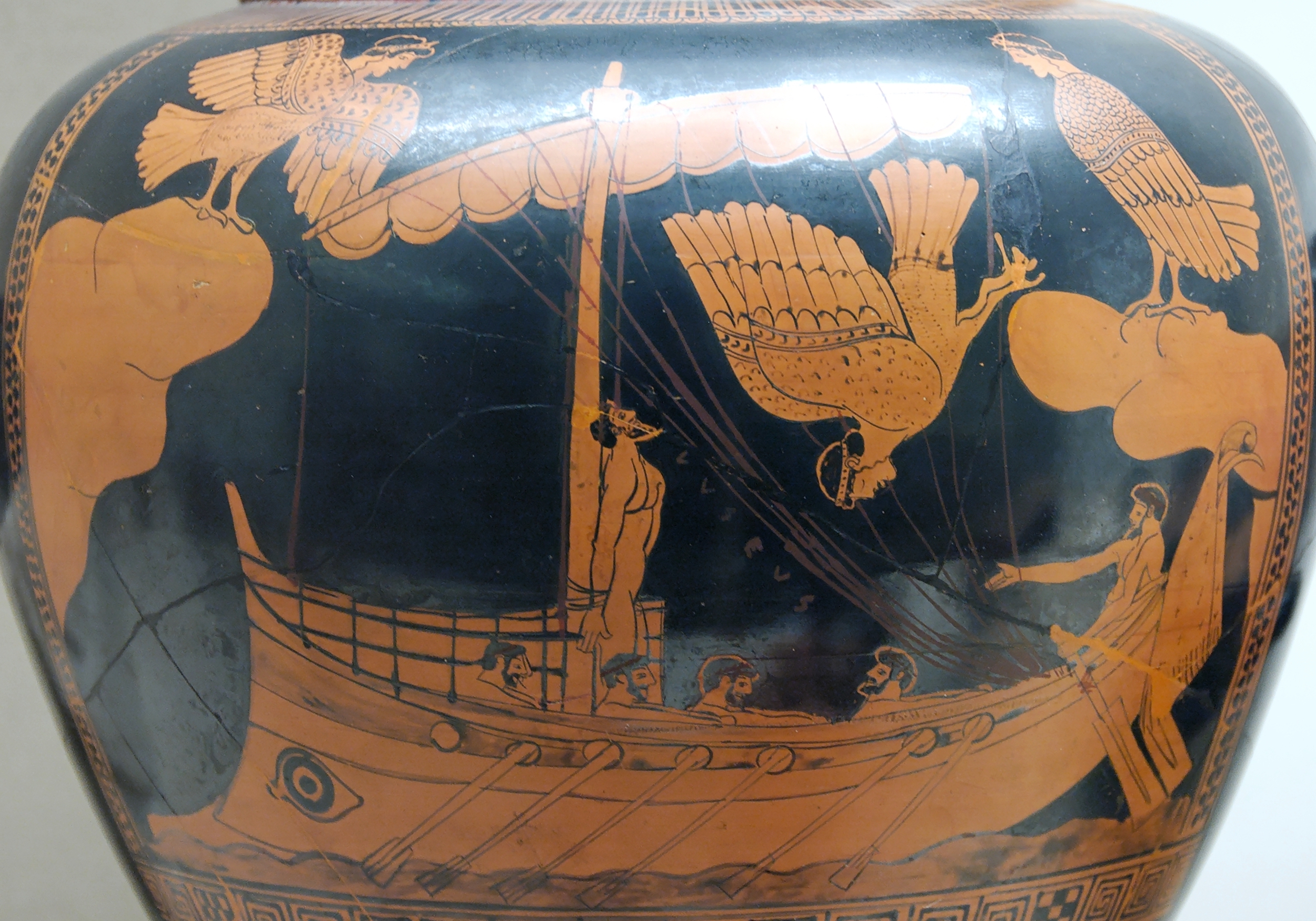
Artist: Adolf Furtwängler (drawing); Siren Painter (vase)
Odysseus and the Sirens. Detail from an Attic red-figured stamnos, ca. 480-470 BC. From Vulci.
Hello, welcome to NascoBlog2.
As promised in NascoBLOG1, I want to tell you about a truly momentous, historical break-through made after recording photographs transmitted from the Google Earth remote sensing satellite spinning high above the Southern Andes Mountains of Peru.
And, how this unique discovery appears to have resolved one of ancient history's greatest mysteries: Did the Greeks gain a prior knowledge of South America by following in the footsteps of Phoenician Trans-Oceanic Navigators. In other words, is there any grain of truth to the legendary voyage of Odysseus as related in Homer's Odyssey?
By an amazing coincidence I had just hit the button to launch my new Photo-Book "Portraits of the Gods" (incorporating the Lost Lands of the Canaanites… in Peru) on to iTunes, I came across a News Report (GREEK REPORTER USA: Stella Tsoltakidou. June 2, 2013) about a fascinating book published a couple of years ago by Dr Enrico Mattievich, (Denver CO. 2010)
Although I am pretty sceptical about many seemingly 'fringe' publications there was sufficient substance in Dr Mattievich's hypothesis that attracted my curiosity and appeared to make a link with my own research. Further, the Work was supported by (the Late) writer and archaeologist, Henrietta Mertz and by Dr Christine Pellech both specialists in Trans-Oceanic Contacts in the Ancient World.
In spite of the fact that Dr Mattievich's book "Journey to the Mythological Inferno" is based around classical Greco-Roman literature texts - Homers Odyssey and the Cadmus Myth written by Ovid, for example, I am a strong believer that much of ancient mythology is deliberate protectionist 'dressage' to disguise social -political- economic and religious elements of a particular regime.
Dr Mattievich summed up his thesis by proposing that Odysseus' journey to the Underworld, and here I quote: 'actually took place in South America. The River Acheron was the Amazon, after a long voyage up-stream Odysseus met the Spirits of the Dead at the confluence of the Rio Santiago and the Rio Marañon'.*
*Answer to the NascoBLOG 1 question was, therefore, Latitude 4º 25' 50''S and 77º 38' 31''W Longtitude.
Dr Pellech suggested Odyssey's voyage to the 'Kingdom of the Dead' was really a trip to America! And, Dr Mertz believed the legendary voyage was a trip to North America, but she also suggested that Jason and the Argonauts may have navigated down the Eastern Atlantic Coast of South America, passed by the mouth of the Amazon and Rio de Janerio until reaching the Rio de Plata in Argentina then followed a route many kilometres upstream arriving at the Bolivian Altiplano and Tiahuanaco.
So, having introduced Homer's Odyssey into the equation how does this link -up with my particular 'momentous discovery'? Ideally, of course, you need a copy of "Portraits of the Gods" which you can obtain as an E-Book from iTunes: simply Click on to:
http://www.nascodexpublications.com/Portraits.html
Just watching and listening to the video recording on the iTunes URL above will give you an excellent summary with pictures as to what the book and discovery is all about. "Portraits" is a historical non-fiction, not-for-profit publication. Book sales go to support the next vital stage of our research programme.
NascoBLOG3 is due on-line on the 26th July 2013 and will continue today's theme linking Greek mythology to my particular discovery that the Phoenicians not only made visitations to South America but actually took up residence for nigh on 800 years, thus giving birth to their 'Kingdom of the Dead', or in my case, the much more gentile title, 'The Phoenician's Heaven on Earth'.
NascoBlog2 question: If Henrietta Merzt's hypothesis were true for South America and the Phoenician Navigators did enter the interior via the Rio de la Plata: which route might they have taken to reach Tiahuanaco and what evidence of Phoenician activity would you look for if you were part of an expeditionary force heading upstream?
Speak to you all again on the 26th July.
William James Veall
Introductory Blog
13/06/13 19:06
From now on I will be posting a NascoBLOG every second and fourth Wednesday of the month, starting July 12th 2013 and then July 26th and so on, even through the holiday time, so wherever you are you can keep up to date.

So, firstly may I introduce myself. My name is William James Veall. I am essentially an Archaeoastronomer but have to be familiar with many cross-disciplines like archaeology, anthropology, ethnology and, naturally, astronomy, plus a whole host of others like epigraphy, cartography, classical sculptures - even the religions of ancient times. I hold more than twenty copyright registrations for archaeological research.
I have been a life-long exponent of solving the mystery behind the Nasca Lines Archaeological Monument and will explain some discoveries relating to this subject in forthcoming NascoBLOGS. I will also recap on some of my original, currently off-line, Nascodex web - pages.
With a scientific engineering background, I am involved in the design of UAV's for student archaeologists - particularly for aerial photography and site survey in remote mountainous and desert terrain.
So, what do I have in store for the July 12th NascoBLOG?
Well, I am going to introduce you to a Trans-Oceanic theory, published a couple of years ago (Mattievich,E. 2010), that Odysseus's journey to the Underworld actually took place in South America and where Odysseus allegedly met the 'spirits of the dead' at the confluence of the Rio Santiago and the Rio Marañon.
So, maps at the ready - see if you can locate this meeting point before NascoBLOG2. Here's a clue. Odysseus was said to have started from the Amazon Basin. (Answer in NascoBLOG 2)
In NascoBLOG2 I will draw a comparison with the hypothetical Odysseus journey and my own research as recorded in my recently published E-Book. "Portraits of the Gods" incorporating "The Lost Lands of the Phoenician - Canaanites in... Peru" (Veall 2013).
I can assure you, the outcome of my research is archaeological dynamite and has changed pre-Columbian history. Forever.
Look forward to meeting you all on the 12th July.
William James Veall
MATTIEVICH,E. 2010 Journey to the Mythological Inferno. Denver CO. USA
VEALL. W.J. 2013 Portraits of the Gods ('The Lost Lands of the Phoenician-Canaanites.. in Peru'. Nascodex Publications: http://www.nascodexpublications/Portraits.html